Your current location:
3D Laser Mapping Supports Collision Investigators Online
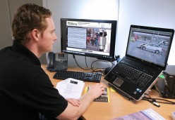
3D Laser Mapping has launched a brand new website to support Police Collision Investigators. As the nationwide rollout of laser scanners continues, this valuable resource offers a secure online forum that allows Collision Investigators to communicate with colleagues around the country, sharing experience and expertise to build an online community. The site also includes up to date information on hardware, accessories and software, as well a range of downloadable reference materials. The regularly updated FAQ section provides solutions to common queries and unanswered questions.
Additional guidance and support is available from a team of dedicated laser scanning professionals and can be accessed at police.3dlasermapping.com
Early users of 3D Laser Mapping's Forensic Investigation web resource include Essex Police. Having recently taken delivery of a RIEGL VZ-400 from 3D Laser Mapping, Duncan Thurlwell, Forensic Collision Investigator commented, "This is a really useful resource to share tips with and seek technical information from other investigators and the experts at 3D Laser Mapping." He continued, "Best practice can be exchanged and it's a way to instantly distribute the learning and development already undertaken by other forces preventing expensive and unnecessary duplication."
Gary Baldwin a Supervisor in the Forensic Collision Investigation Unit of Hampshire and Thames Valley Police Joint Operations Unit (JOU) added, "I am sure this forum will become the main port of call for tips and information to progress our scanning skills. It has already proved extremely useful when integrating our GPS system and is the ideal tool to keep in touch with officers spread over 4 counties."
Over half of the Police Forces awarded funding by the Department of Transport for the purchase of high tech laser scanners have purchased RIEGL devices from 3D Laser Mapping. The state of the art laser scanning systems will be used to rapidly collect evidence at the scene of collisions, helping to reduce the length of road or lane closures and minimise congestion on roads. Data collected by the scanners will be used by to produce high quality graphics and detailed plans of collision scenes for use in subsequent enquiries and court cases.
"Although extensive trials of laser scanners have been completed, this is still a relatively new application of this technology," commented 3D Laser Mapping's Managing Director Jon Chicken. "We therefore wanted to provide as much information and support as possible in an easy to access way. The online forum is intended to be a sharing platform allowing users to interact with other investigators in order share best practice, discuss common support issues and access training materials and product upgrades."
For further information contact:
Charlie Whyman, 3D Laser Mapping Ltd,
charlie.whyman@3dlasermapping.com
Tel: +44 (0) 1949 838 004
www.3dlasermapping.com